Derby Line, VT
Advertisement
Derby Line, VT Map
Derby Line is a US city in Orleans County in the state of Vermont. Located at the longitude and latitude of -72.098990, 45.005050 and situated at an elevation of 322 meters. In the 2020 United States Census, Derby Line, VT had a population of 687 people. Derby Line is in the Eastern Standard Time timezone at Coordinated Universal Time (UTC) -5. Find directions to Derby Line, VT, browse local businesses, landmarks, get current traffic estimates, road conditions, and more.
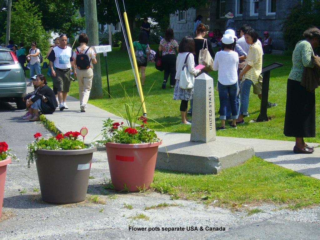
Derby Line, located in the state of Vermont, is a unique village known for its intriguing international boundary with Stanstead, Quebec, Canada. A fascinating element of this boundary is the Haskell Free Library and Opera House, a historic building that straddles the border, allowing visitors to experience two countries under one roof. This library is renowned for having its entrance in the United States and its reading room in Canada, making it a symbol of cross-border harmony and collaboration. The village's streets are marked with boundary lines, making it a one-of-a-kind destination for those interested in geography and international relations.
Historically, Derby Line has been a testament to the close-knit relationship between the United States and Canada. Established in the early 20th century, the Haskell Free Library and Opera House was intentionally built on the border to serve both communities. Visitors can enjoy performances and events in the opera house, which offers a glimpse into the cultural fabric of the area. Additionally, the village's quaint atmosphere, complete with charming architecture and picturesque landscapes, provides a peaceful retreat for those looking to explore a small town with a big international presence.
Nearby cities include: Derby Center, VT, Holland, VT, Newport, VT, Morgan, VT, Coventry, VT, Warren's Gore, VT, Norton, VT, Orleans, VT, North Troy, VT, Irasburg, VT.
Places in Derby Line
Dine and drink
Eat and drink your way through town.
Can't-miss activities
Culture, natural beauty, and plain old fun.
Places to stay
Hang your (vacation) hat in a place that’s just your style.
Advertisement


