Ambridge, PA
Advertisement
Ambridge, PA Map
Ambridge is a US city in Beaver County in the state of Pennsylvania. Located at the longitude and latitude of -80.225000, 40.593060 and situated at an elevation of 764 meters. In the 2020 United States Census, Ambridge, PA had a population of 6,972 people. Ambridge is in the Eastern Standard Time timezone at Coordinated Universal Time (UTC) -5. Find directions to Ambridge, PA, browse local businesses, landmarks, get current traffic estimates, road conditions, and more.
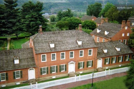
Ambridge, located in Pennsylvania, is a town that is steeped in rich industrial history, primarily known for its origins tied to the American Bridge Company. This company, once a giant in steel fabrication, laid the foundation for Ambridge's development in the early 1900s and contributed significantly to the town's growth. This industrial heritage is celebrated at the Old Economy Village, a National Historic Landmark, which offers a glimpse into the 19th-century communal lifestyle of the Harmony Society, a religious community that predated the town's industrial boom. Visitors can explore preserved buildings, gardens, and exhibits that provide insight into this unique aspect of Ambridge's past.
In addition to its historical attractions, Ambridge is known for its charming main street, where local businesses and eateries offer a welcoming atmosphere. The town hosts various community events throughout the year, such as the Ambridge Nationality Days, which celebrate cultural diversity with food, music, and dance. For those interested in architecture, the Laughlin Memorial Library stands out as a beautiful example of early 20th-century design. Ambridge's blend of history, culture, and community spirit makes it a notable stop for those exploring the region.
Nearby cities include: Harmony, PA, South Heights, PA, Leet, PA, Leetsdale, PA, Aliquippa, PA, Bell Acres, PA, Baden, PA, Edgeworth, PA, Economy, PA, Sewickley Heights, PA.
Places in Ambridge
Dine and drink
Eat and drink your way through town.
Can't-miss activities
Culture, natural beauty, and plain old fun.
Places to stay
Hang your (vacation) hat in a place that’s just your style.
Advertisement


