Aliquippa, PA
Advertisement
Aliquippa, PA Map
Aliquippa is a US city in Beaver County in the state of Pennsylvania. Located at the longitude and latitude of -80.263056, 40.615000 and situated at an elevation of 850 meters. In the 2020 United States Census, Aliquippa, PA had a population of 9,238 people. Aliquippa is in the Eastern Standard Time timezone at Coordinated Universal Time (UTC) -5. Find directions to Aliquippa, PA, browse local businesses, landmarks, get current traffic estimates, road conditions, and more.
Aliquippa, located in Pennsylvania, is a city with a rich industrial history, primarily known for its steel production legacy. The city flourished in the early to mid-20th century thanks to the Jones and Laughlin Steel Corporation, which played a significant role in its development and population growth. Although the steel mills have long since closed, the city retains a sense of its industrial past, with remnants visible in its architecture and local culture.
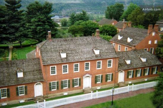
Visitors to Aliquippa can explore its historical sites and enjoy local recreational activities. One notable spot is the Old Economy Village, a National Historic Landmark that offers insights into communal living in the 19th century. The city also features several parks, with the largest being the Aliquippa Community Park, which provides trails, picnic areas, and sports facilities for outdoor enthusiasts. For those interested in learning more about the region's history, the B.F. Jones Memorial Library is not only an architectural gem but also a resource for historical research and community events.
Nearby cities include: Harmony, PA, Ambridge, PA, Baden, PA, South Heights, PA, Conway, PA, Independence, PA, Leet, PA, Leetsdale, PA, Economy, PA, Freedom, PA.
Places in Aliquippa
Dine and drink
Eat and drink your way through town.
Can't-miss activities
Culture, natural beauty, and plain old fun.
Places to stay
Hang your (vacation) hat in a place that’s just your style.
Advertisement


