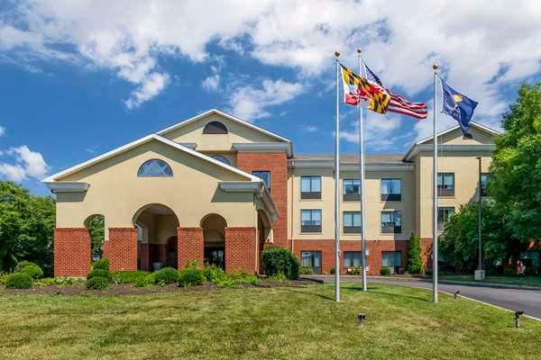
Still Pond, MD
Advertisement
Still Pond, MD Map
Still Pond is a US city in Kent County in the state of Maryland. Located at the longitude and latitude of -76.045600, 39.329200 and situated at an elevation of 75 meters. In the 2020 United States Census, Still Pond, MD had a population of 131 people. Still Pond is in the Eastern Standard Time timezone at Coordinated Universal Time (UTC) -5. Find directions to Still Pond, MD, browse local businesses, landmarks, get current traffic estimates, road conditions, and more.
Still Pond, Maryland, is a quaint and historically rich community known for its serene landscapes and charming, small-town atmosphere. One of the most significant aspects of Still Pond is its historical pedigree, with the entire village designated as a historic district. Visitors can explore the well-preserved architecture that dates back to the 18th and 19th centuries, offering a glimpse into the past of rural Maryland. The Still Pond Historic District is a notable highlight, featuring a collection of buildings that reflect the architectural styles and community planning of the era.
In addition to its historical appeal, Still Pond is surrounded by the natural beauty of Maryland's Eastern Shore. The nearby Still Pond Creek offers opportunities for kayaking and canoeing, providing a tranquil escape into nature. The local community often hosts events and activities that celebrate the area's rich heritage and close-knit ambiance, making it a delightful destination for those interested in history, nature, and rural American culture. Whether you're exploring its historical sites or enjoying the peaceful surroundings, Still Pond offers a unique experience that captures the essence of Maryland's past and present.
Nearby cities include: Betterton, MD, Kennedyville, MD, Worton, MD, Chestertown, MD, Crumpton, MD, Galena, MD, Cecilton, MD, Aberdeen Proving Ground, MD, Millington, MD, Tolchester, MD.
Places in Still Pond
Dine and drink
Eat and drink your way through town.
Can't-miss activities
Culture, natural beauty, and plain old fun.
Places to stay
Hang your (vacation) hat in a place that’s just your style.
Advertisement


