10 Lost Islands

By: Patrick J. Kiger
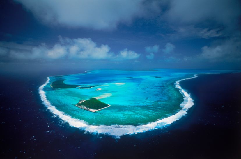
Aitutaki atoll
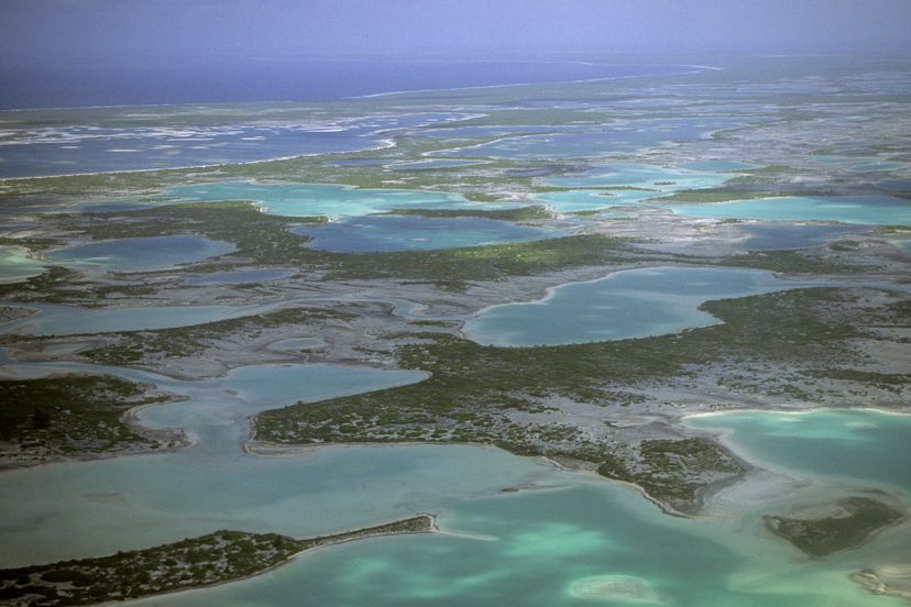
The Aitutaki atoll in the Cook Islands does exist but at least one island around it may not. Chad Ehlers/Getty Images

Islands have long have occupied a special place in the human imagination. "So close to our own world, yet so out of reach, they have been the landscapes where no life form was unimaginable, no occurrence impossible," as Miles Harvey noted in his 2000 book "The Island of Lost Maps."

That's why we have stories from Greek mythology of islands like Circe, where men are transformed into pigs, or Cyclopes Island, where one-eyed giants eat human flesh. The classical Greek philosopher Plato wrote of a massive, vanished land mass called Atlantis, which once existed west of the Straits of Gibraltar. In Plato's tale, Atlantis was a "great and wonderful empire" that conquered the lands surrounding the Mediterranean, until finally it was defeated by the Athenians and their allies. Then, apparently, the gods became displeased with Atlantis, and violent earthquakes and floods caused it to sink in one single day.

Advertisement

Atlantis, as Plato described it, seems to have existed only in his rich imagination. Nevertheless, it's hard to totally dismiss the possibility that it was based upon a real place. After all, plenty of islands have disappeared from maps, and some of them were real places. Others existed only in imagination, and still others live in that shadowy place between fact and fiction. Here are stories of 10 lost islands.
10: Vordonisi - Reappeared After 1,000 Years

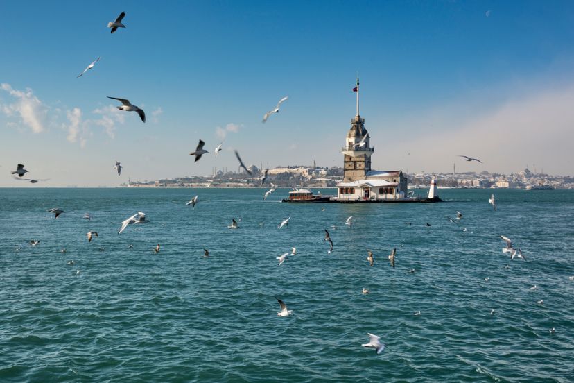
Maiden's Tower
The Maiden's Tower situated on an inlet in the Mamara Sea, Turkey was built during the Byzantine period, just like the monastery on Vordonisi. Ayhan Altun/Getty Images

Vordonisi, an island in Turkey's Mamara Sea, vanished in 1010 C.E. after an earthquake. But in 2013, seismic activity apparently caused the sunken land to begin to rise again [source: Atherton].

Before it disappeared, the island, just 1 square mile (2.5 square kilometers) in area, was the site of a monastery built by a Byzantine patriarch named Photius I, in 886. Photius had been banished to the island by Byzantine Emperor Leo VI, because of accusations that Photius had participated in a conspiracy against Leo's predecessor, Basil I [source: Atherton].

Advertisement

After researchers identified the site from ancient maps, divers photographed the underwater ruin. Ali Kılıç, mayor of the Istanbul district of Maltepe, told a Turkish newspaper that he hoped the island would be recognized by the United Nations and earn a spot on its World Heritage List [source: Anadolu Agency].

In 2016, just a few visual traces of the island can be spotted — flashes of light on the water over it, which are caused by reflections from the top of the sunken monastery. But archaeologists hope to uncover more.

9: New Moore Island/South Talpatti - Done in By Global Warming

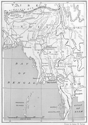
map, Bay of Bengal
A vintage map of the Bay of Bengal shows a number of islands in the waters surrounded by India, Burma (now Myanmar) and Siam (now Thailand).
 Smith Collection/Gado /Getty Images

For several decades, the nations of India and Bangladesh squabbled over who had sovereignty over a tiny island in the Bay of Bengal. The Indians called it New Moore Island, while the Bengalis referred to it as South Talpatti. Regardless of which name you chose, there wasn't much to it. The island was just 2 miles (3 kilometers) long and 1.5 miles (2 kilometers) wide, and had no permanent buildings on it. Nevertheless, in 1981, India went so far as to send paramilitary fighters to occupy the island and hoist the Indian flag above it.

But all that nationalistic fuss over sovereignty was for nothing, because global warming — which causes rising sea levels — ultimately resolved the conflict. By 2010, sea patrols and satellite imagery confirmed that New Moore Island/South Talpatti had sunk beneath the water and vanished.

Advertisement

But while the disputed island's fate wasn't all that significant in the scheme of things, it was an ominous indication of what the future may hold for other, more populous islands in the Bay of Bengal. As many as 10 local islands are at risk from rising sea levels [source: Associated Press].

8: Maui Nui - Broke Into Four Islands

Na Pali coast in Kauai, Hawaii
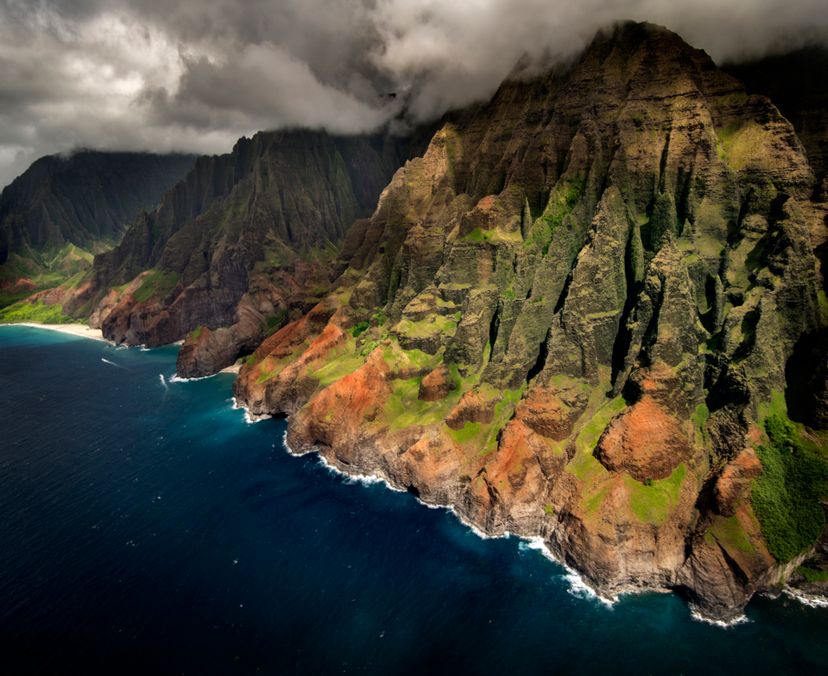
An aerial view of the Na Pali coast in Kauai, Hawaii. Four of the Hawaiian islands were once all part of a huge land mass called Maui Nui. Enrique R Aguirre Aves/Getty Images

Hawaii is the biggest island in the Hawaiian archipelago, but it hasn't always been that way. The four modern islands of Maui, Moloka'i, Lana'i and Kaho'olawe once were all connected in one gigantic land mass that scientists have dubbed Maui Nui (which in the Hawaiian language means "big Maui"). At its peak size 1.2 million years ago, Maui Nui stretched for 5,640 square miles (14,600 square kilometers), making it about 50 percent bigger than the island of Hawaii is today [source: Hawaii Volcano Observatory].

Maui Nui was a land of multiple volcanoes, created by spewing vast amounts of lava from Earth's upper mantle. But what made the island so big also contributed to its demise. As the volcanoes gradually stopped building up the land, the weight of all that lava eventually caused the oceanic crust to buckle and subside. That caused the connections, or saddles, between the volcanoes eventually to sink beneath the water, which gradually split the volcanoes into separate islands.

Advertisement

But even though Maui Nui no longer exists as a single island, its presence is still felt. Species spread across its land mass before it separated, so the four islands that resulted have very similar flora and fauna [source: Hawaii Volcano Observatory].

7: Ferdinandea - Disappeared and Reappeared Many Times

volcano, Stromboli, Sicily
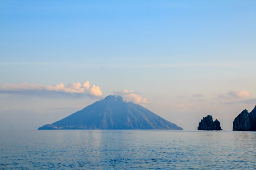
The volcano on the island of Stromboli off the coast of Sicily has erupted many times. Volcanic activity on the island of Ferdinandea has caused it appear and disappear. Frans Sellies/Getty Images

As far as lost islands go, Ferdinandea — about 19 miles (31 kilometers) off the southern coast of Sicily — is a particularly odd example. That's because throughout history, the island, which actually is the tip of a submerged volcano, has reappeared multiple times, only to disappear again beneath the waves before anyone can decide to which nation it belongs.

The first recorded emergence of Ferdinandea was in ancient times, when it rose above the waves after underwater volcanic eruptions during the first Punic War in 264-241 B.C.E. when the Romans and Carthaginians probably bickered about whom it belonged to.

Advertisement

In July 1831, thanks to more volcanic activity, Ferdinandea again appeared. It had a circumference of about 3 miles (5 kilometers) and rose about 213 feet (65 meters) above water level. Great Britain, Spain and the then-kingdom of Sicily all laid claim to it. Sicily's ruler Ferdinand II dubbed it Ferdinandea, after himself, while the British called it Graham Island, after James Graham, the second baronet of Netherby [sources: New York Times, Nethery].

Before they could resolve the matter, though, the island again sank below the water, six months after appearing. In 2002, heavy seismic activity made scientists think a re-emergence was likely. To get a jump on things, Sicilian divers planted a flag on the rock, hoping to claim it for Italy the minute it reappeared. But Ferdinandea stayed under water [source: The New York Times].

6: Tuanaki - A Place of Feasting and Dancing

Cook Islands map
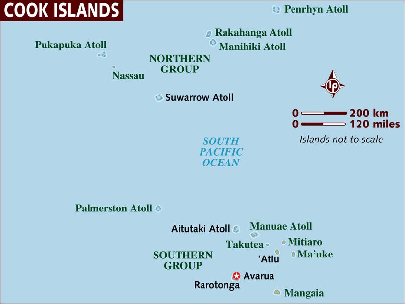
This map of the Cook Islands shows Mangaia in the lower right, but Tuanaki is not present. Lonely Planet Images/Getty Images

In the 1840s, a man named Soma from the South Pacific's Cook Islands told missionaries that he'd visited an island called Tuanaki while working on the crew of a ship. He described having gone ashore to explore the island at the behest of his somewhat fearful captain, who gave him a sword to protect himself in case the inhabitants turned out to be hostile.

But when Soma found the locals, they turned out to be utterly convivial. "We don't fight, we only know how to dance," they told him. Eventually he brought the captain ashore, and they stayed for six days, feasting and returning to the ship laden with pork, yams, bananas, coconuts and other food. Soma recalled that island's residents had an living arrangement, in which men and women dwelled in separate houses [source: Maretu].

Advertisement

Soma said Tuanaki was located a day's journey, or about 62 miles (100 kilometers), from the island of Mangaia. The island was thought to be about half a square mile (1.3 square kilometers) [source: Nunn].

The missionaries were eager to visit Tuanaki. But on two separate voyages, in 1844 and again in 1856, they were unable to find it. Maybe it sank beneath the ocean, or perhaps Soma simply made up the whole story. However since other informants of the time also mentioned Tuanaki, some people think it really did exist [source: Nunn].

5: Bermeja - Vanished By Conspiracy?

island, Mexico
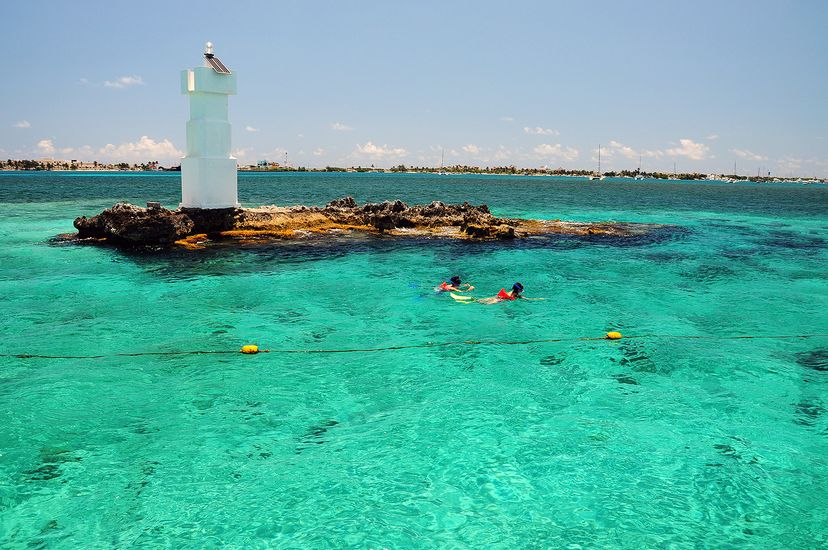
People snorkel off a tiny island off the coast of Mexico. Could Bermeja have really existed? Picardo/Getty Images

Here's a geographical mystery for you. An island in the middle of the Gulf of Mexico has gone missing, and nobody has been able to figure out what happened to it.

The island of Bermeja appeared on maps from the 1500s to the 1700s, a tiny dot of land lying roughly 55 nautical miles (102 kilometers) off the northwest coast of the Yucatan Peninsula. It was too small to be of much interest to anybody until the 2000s, when the U.S. and Mexican governments both began to covet rich oil deposits in the Gulf of Mexico. Mexican legislators spotted the tiny island on some old maps, and realized that its presence would extend Mexico's territorial limits and give the country a claim to more of the oil.

Advertisement

The problem, though, was that when researchers from the National Autonomous University of Mexico started looking for the island from the air, they couldn't find it. Studies with underwater sensing devices couldn't locate a submerged land mass in that area, either. They concluded that contrary to the old maps, the island didn't actually exist.

Not everyone, though, was willing to accept the notion that old-time cartographers had simply made a mistake. A conspiracy theory took hold that the U.S. secretly had bombed the island and blown it to bits, in order to solidify its claim to the oil. However, Julio Zamora, president of Mexico's Society of Geography, told Lonely Planet it was common for mapmakers in the 16th and 17th centuries to create maps with errors so enemy countries would not use them [sources: Stevenson, Wilson].

4: Sandy Island - Bigger Than Manhattan, Never Existed

Sandy Island
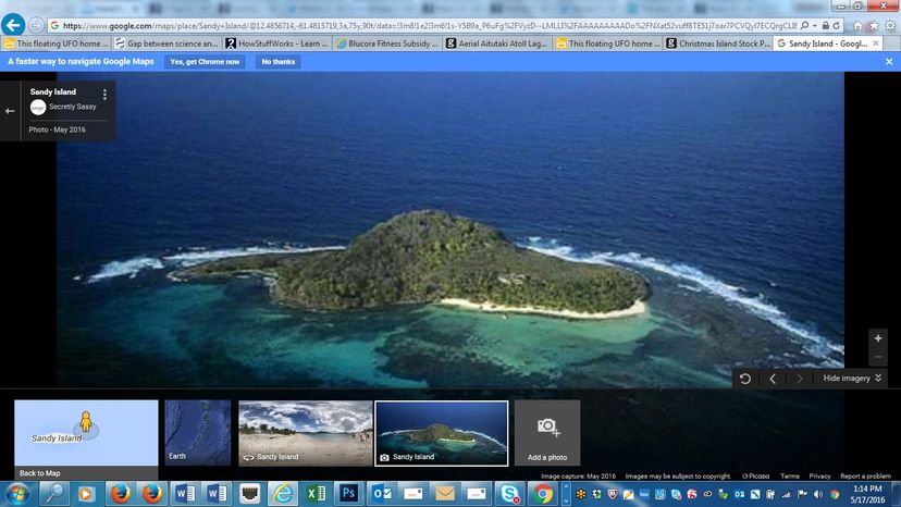
This is the picture of Sandy Island displayed by Google Maps, though an accompanying note says the island is non-existent. Google Maps

Sandy Island, also known as Sable Island, is located between Australia and the French-controlled island of New Caledonia in the Coral Sea. It's depicted as being about 15 miles (24 kilometers) long and 45 square miles (117 square kilometers) in area, which makes it about one-and-a-half times the size of Manhattan [source: Krulwich].

Or at least that's what numerous maps — from a 1908 chart to Google Maps — have depicted over the years. The problem, though, is that when University of Sydney researchers sailed a ship into the area to visit Sandy Island in 2012, they didn't find anything except ocean.

Advertisement

"It's on Google Earth and other maps so we went to check and there was no island. We're really puzzled," one of the scientists, Dr. Maria Seton, explained in a 2012 BBC interview.

What's even odder, though, is that some people had reported seeing Sandy Island, though not recently. Back in 1772, British explorer James Cook passed close to it, and sailors on the British ship Velocity apparently saw it when they sailed by in 1876. But nobody ever actually set foot on it.

Now those accounts seem a bit fishy. The Australian researchers decided to visit the island because sonar maps of the sea floor showed very deep water where Sandy was supposed to be. As geologists, they wondered how a land mass could be floating on the surface, with no substructure or seamount beneath it. It just didn't seem plausible. And as it turns out, it wasn't [source: Krulwich].

Google Maps now describes Sandy Island as "nonexistent" but still provides a ground-level view of a sandy beach.

3: Mauritia - Vanished in the Time of the Dinosaurs

Le Morne Brabant, Mauritius
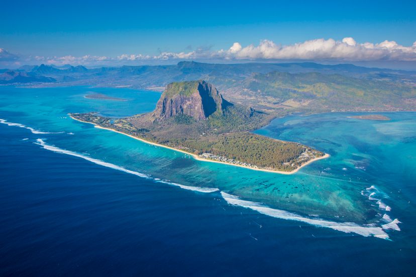
A view of Le Morne Brabant, a peninsula at the tip of Mauritius with a huge monolith full of caves. Jon Arnold/Getty Images

Mauritia, which was located in what is now the Indian Ocean, was a lost island that no person ever saw. That's because it vanished while dinosaurs walked Earth, long before humans existed. So how do we know it was ever there?

The story of Mauritia actually starts with Rodinia, an ancient supercontinent that once included all of the dry land on Earth. About 750 million years ago, Rodinia started to fragment, and one of the pieces that broke loose was Mauritia. It was a quarter of the size of present-day Madagascar.

Advertisement

Mauritia existed for a long time. But 85 million years ago, as Earth's land continued to shift, the microcontinent started to break up. Eventually, it vanished into the ocean.

But pieces of Mauritia may remain, possibly on the floor of the Indian Ocean. There's probably also some of the lost island deep down in Earth, about 6 miles (10 kilometers) below modern Mauritius, a much smaller volcanic island in the Indian Ocean that appeared 9 million years ago. In 2013, scientists who'd analyzed sand from its beaches discovered the presence of minerals that were much, much older — about the age that you'd expect to find in a continental crust. That led them to figure out that Mauritia had once existed [source: Morelle].

2: Sarah Anne Island - Lost to Clerical Error

Christmas Island
Sarah Anne Island was supposedly off the coast of Christmas Island (shown here) but it turned out the spotters had written down the wrong coordinates. cliffwass/Getty Images

In 1858, a ship crew representing the New York Guano company — yes, there once was such an enterprise — was out searching in the Pacific for promising sources of bird poop fertilizer. They discovered a tiny island, which they named Sarah Anne and claimed for the company. They marked it down as latitude 4 north, longitude 154.22 west. Mariner's charts put it slightly to the northeast of Christmas Island,

Fifteen years later, the USS Portsmouth tried without success to find Sarah Anne Island at those coordinates. The U.S. government's official mapmakers, though, refused to concede that it didn't exist.

Advertisement

None of that really mattered much until 1937, when astronomers started preparing to observe an eclipse. The event would only last for seven minutes, and the scientists figured out that the only dry land in the Pacific that gave them a suitable vantage point during that time was Sarah Anne Island.

So the government mapmakers scrutinized the chart again. Their conclusion was that someone had written down the coordinates slightly wrong — it should have been latitude 4 south, which matched the coordinates for Independence Island (or Malden Island), another land mass that was near Christmas Island. So Sarah Anne became the only island ever to vanish due to clerical error [source: Associated Press].

1: Kane - A Peninsula That Was Once an Island

Oludeniz
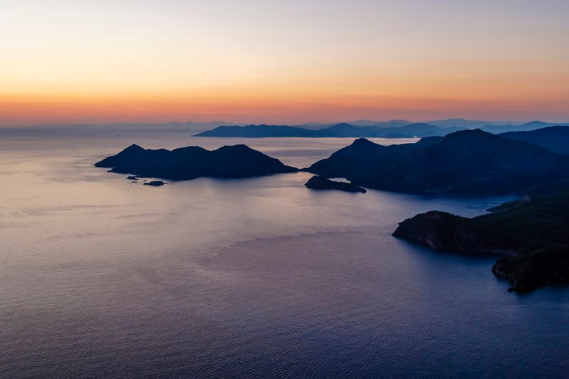
Oludeniz is a small village and beach resort in southwestern Turkey, at the conjunction point of the Aegean and Mediterranean seas. The Garip Islands are also in the Aegean Sea but uninhabited. Danita Delimont/Getty Images

The Garip Islands, a pair of tiny islands that lie in the Aegean Sea a few hundred yards off the coastline of Turkey, don't seem like they would be a very significant place. But back in 406 B.C.E., when they were called the Arginusae Islands, they were near the site of an important naval battle between Athens and Sparta in the Peloponnesian War.

The odd thing, though, is that ancient written sources indicate there actually were three Arginusae Islands, not two. The third supposedly was the site of the ancient port city of Kane. For years, scholars puzzled over that inconsistency, because the location now is a peninsula. Maps from the Ottoman Empire showed that it had been part of mainland Turkey since at least the 1500s.

Then, finally, in 2015, researchers discovered the answer. They drilled deep into the ground and discovered evidence — including the remains of an ancient harbor — that the peninsula actually had once been an island. Apparently, some time before the 1500s, earthquakes or sediment eroded from nearby farm fields and created a land bridge [source: Romeo].

Lots More Information

Author's Note: 10 Lost Islands

I've been fascinated with the idea of lost islands since I first heard the British pop singer Donovan's 1969 single "Atlantis," which took considerable literary license with original legend described by Plato, and with Greek mythology in general. It also contains a wonderfully nonsensical reference to "my antediluvian baby" that's been puzzling me for decades.

Related Articles

More Great Links

  • Anderson, Elizabeth S. "10 Forgotten Lands Submerged by the Ocean." Listverse. Feb. 28, 2015. (May 7, 2016) http://bit.ly/1OitQXr
  • Anadolu Agency. "Researchers set to discover Istanbul's lost island." Hurryiet Daily News. May 8, 2016. (May 8, 2016) http://www.hurriyetdailynews.com/researchers-set-to-discover-istanbuls-lost-island--.aspx?PageID=238&NID=95847&NewsCatID=341
  • Associated Press. "Island claimed by India and Bangladesh sinks below waves." Guardian. March 24, 2010. (May 7, 2016) http://bit.ly/1Wg2bhv
  • Associated Press. "Pacific Island Was 'Missing' Because of a Clerical Error." Spokane Daily Chronicle. July 19, 1937. (May 7, 2016) http://bit.ly/1OitxMj
  • Associated Press. "Vanishing of Sarah Ann, Tiny Pacific Island, Causes Scientists Much Worry." Ludington Daily News. Oct. 16, 1932. (May 7, 2016) http://bit.ly/1Oitv77
  • Atherton, Matt. "Turkey: Lost ancient island of Vordonisi to be revealed 1,000 years after being submerged by earthquake." International Business Times. March 1, 2016. (May 7, 2016) http://www.ibtimes.co.uk/turkey-ancient-sunken-island-vordonisi-be-revealed-once-more-underwater-1546827
  • BBC News. "South Pacific Sandy Island 'proven not to exist'." BBC News. Nov. 22, 2012. (May 8, 2016) http://www.bbc.com/news/world-asia-20442487
  • BBC Two. "Oceans: Exploring Secrets of Our Underwater World." BBC. (May 7, 2016) http://www.bbc.co.uk/oceans/locations/mediterranean/ferdinandea.shtml
  • BBC World Service. "Mexico's Missing Island." BBC. Sept. 10, 2009. (May 7, 2016) http://www.bbc.co.uk/worldservice/documentaries/2009/09/090910_world_stories_mexico_missing_island.shtml
  • Campbell, Hamish. "The Zealandia Drowning Debate: Did New Zealand Sink Beneath the Waves?" Bridget Williams Books. 2013. (May 7, 2016) http://bit.ly/1OitJv4
  • Cook Islands Museum and Library Society. "The case of the missing islands: Tuanaki and Victoria." Cook-islands-library-museum.org. Sept. 22, 2011. (May 7, 2016) http://cook-islands-library-museum.org/the-case-of-the-missing-islands-tuanaki-and-victoria/
  • Gardner, Nicky and Kries, Suzanne. "Jordsand." Hidden Europe. (May 7, 2016) http://www.hiddeneurope.co.uk/swallowed-by-the-sea-jordsand
  • Google Maps. "Sandy Island." Google Maps. (May 8, 2016) http://bit.ly/1Zva4xK
  • Harff, J. Bailey, G. and Luth, F. "Geology and Archaeology: Submerged Landscapes of the Continental Shelf." Geological Society of London. 2016. (May 7, 2016) http://bit.ly/1OitPTh
  • Harvey, Miles. "The Island of Lost Maps: A True Story of Cartographic Crime." Random House. 2000. (May 7, 2016) http://bit.ly/1ZuGWa3
  • Hawaiian Volcano Observatory. "Once a big island, Maui County now four small islands." USGS. April 10, 2003.(May 8, 2016) http://on.doi.gov/1ZuPuh5
  • Krulwich, Robert. "Pacific Island, Bigger Than Manhattan, Vanishes." NPR. March 15, 2013. (May 8, 2016) http://n.pr/1Zv8Suj
  • Matetu. "Cannibals and Converts: Radical Change in the Cook Islands." Institute of Pacific Studies. 1983. (May 7, 2016) http://bit.ly/1OitCiZ
  • Metafilter. "The lost island of Ferdinandea, AKA Graham Island, AKA Île Julia." Metafilter.com. July 11, 2013. ( May 7, 2016) http://bit.ly/1OitT5A
  • Morelle, Rebecca. "Fragments of ancient continent buried under Indian Ocean." BBC News. Feb. 25, 2013. (May 9, 2016) http://www.bbc.com/news/science-environment-21551149
  • Nethery, W. James. "Graham's Island (Ferdinandea) named after
  • Sir James Graham." Clan Graham Society. (May 8, 2016) http://www.clangrahamsociety.org/placesferdinandea.html
  • The New York Times. "Volcanic Island Could Rise After 170 Years Under Sea." The New York Times. Nov. 26, 2002. (May 7, 2016) http://nyti.ms/1OitWOH
  • Nunn, Patrick D. "Vanished Islands and Hidden Continents of the Pacific." University of Hawaii Press. 2009. (May 8, 2016) http://bit.ly/1Zv2bIJ
  • Plato. "Timaeus." Classics.mit.edu. (May 8, 2016) http://bit.ly/1ZuH9de
  • Romeo, Nick. "Lost Island of Ancient Greece Discovered in Aegean Sea." National Geographic. Nov. 20, 2015. (May 9, 2016) http://bit.ly/1UMM0Hm
  • Stevenson, Mark. "Mexico vows to keep looking for 'lost' island." Associated Press, via San Diego Union-Tribune. June 24, 2009. (May 8, 2016) http://bit.ly/1Zv4Sda
  • Stewart, Iain. "Echoes of Plato's Atlantis." BBC. Feb. 17, 2011. (May 8, 2016) http://www.bbc.co.uk/history/ancient/greeks/atlantis_01.shtml

Advertisement

Loading...